August of 2014 I set out on a week of day hikes near Stanley, Idaho. I did 6 hikes in 7 days, the plan was to do 8 hikes in 9 days but being 57 years old and 40 lbs over weight slowed me down. I parked my travel trailer in a free camping area near Stanley Lake and got it set up for the week. My intention was to drive to a trailhead every morning do a day hike to a preplanned location and hike back in time to call home so my family would know I had safely returned. It worked very well I actually got back by 3pm twice. It was very enjoyable to come home covered in sweat, take a 3 minute shower, eat and recover during the evening. I highly recommend this plan.
I use a hiker's guide on most of my hikes. I bought "The Day Hiker's Guide to Stanley, Idaho by Scott Marchant". For this trip I took photos of the pages and maps of the hikes I was going on with my iphone so I could easily carry it with me. That also worked well. I recommend spending the money for Scott's guide book, it is well worth it.
Arriving Saturday morning I got my trailer set-up by about noon and got ready for my first hike. I carry a day pack which weighs about 8 pounds fully loaded. Of course my camera and monopod add a bit to that. According to Scott this is a 7.9 mile round trip to Bridal Veil Falls and will take 2 hours 45 minutes to 4 hours. I took about 6 hours 30 minutes because I stop for photos, notes and because I climbed all the way up to Bridal Veil Falls.
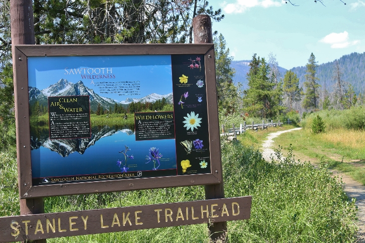
I started out at 12:30pm from the trailhead at Stanley Lake Inlet. There is a trailhead just before the campground on the right which is probably best but I started from the parking area at the beach on the lake. There is a spot you have to cross where the road to the beach goes through some water. It looks bad but I pulled my 19 foot travel trailer through it and back through without a problem.
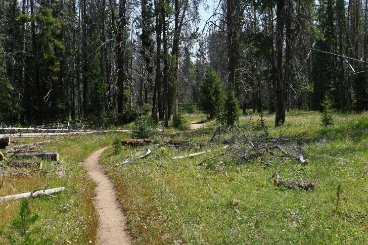
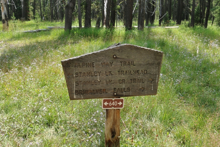
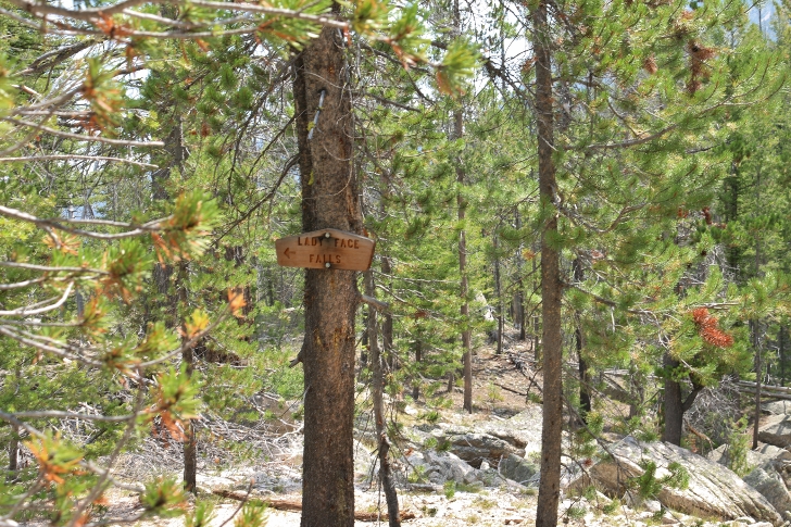
At the trailhead the path is level and passes through a wide flat valley which varies from patches of willows to grassy meadows with tons of wild flowers. You begin near Stanley Lake Creek and wander slowly away from it. According to Scott you will find a marked fork in the trail at 1.9 miles, it didn't seem that far to me. The way is clearly marked so don't worry about it. Not far after that the trail begins to rise and you will hear Lady Face Falls to your left. At 2.4 miles as you top a hill watch for the sign on your left for the .1 mile trail leading to the falls.
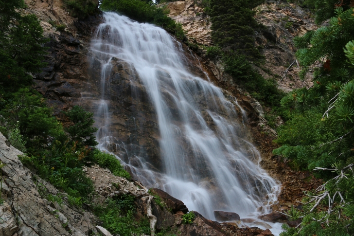
Be careful around the falls as the ground slopes toward the canyon and it would be easy to fall in which would probably be fatal. I climbed into the canyon below the falls thinking I might work my way up to the falls and get a good picture of the main fall. That didn't work out, I have included a couple pictures of my efforts.
When you return to the path it is only about a quarter of a mile until you reach the spot where the trail crosses the creek. If you make this hike early in the season you will not be able to continue if the runoff is running high. In August the water was only 6 to 8 inches deep. I carried water shoe which I changed into but I am quite sure I was the only one that didn't just splash across. Speaking of others I passed or was passed by 20 to 25 hikers of all ages, sizes and shapes. The most interesting to me was a mother with her 20ish year daughter wearing tank tops, shorts and running shoes walking along talking a mile a minute. Not sure they really saw the beautiful mountains surrounding them. :)
After the crossing, the trail continues up the valley and climbs gently. At 3.6 miles a trail forks off on your right. I followed Scott's advice and went another .2 of a mile to a signed trail indicating Bridal Veil Falls. There is a "view point" just a few yards beyond. I have included a picture from that location. After a few pictures I followed the trail to and crossed the creek again switching to my water shoes. Following this route brings you to the east side of Hanson Lakes Creek. There are primitive trails crisscrossing their way up the mountain to just below the falls on this side of the creek. To climb from Stanley Lake Creek to the foot of the falls is about 500 feet in elevation gain on a very poor and somewhat washed out trail. Most people won't make that climb. There was a thunderstorm moving through the area as I climbed to the falls with lightning flashing and thunder rolling but somehow I missed all the rain. However it was a very wet trail going home.
The guide book indicates that the view near the creek is the best you will get and it is not worth continuing on. I strongly disagree, yes it was a very hard hike to the foot of the fall but I found it very worthwhile.
I hope you enjoy my review of this hike.
RogerThis is the trailhead along Stanley Lake Creek.
N 44 13.855' by W 115 05.941'
The elevation here is 6516 feet.
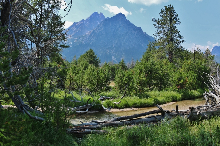
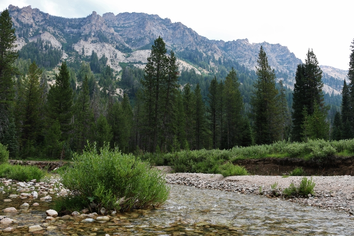
You will be hiking along Stanley Lake Creek a large portion of the hike. This view is only a short distance from the trailhead. Mount McGowen with Stanley Lake Creek in the foreground.
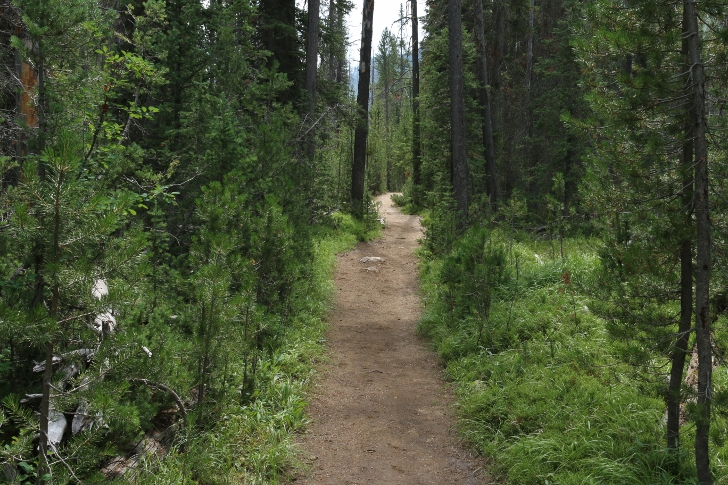
This is typical of the trail for about 1.5 miles.
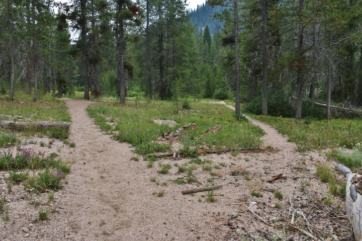
The sign says go right but it's really pretty much straight ahead.
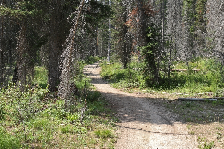
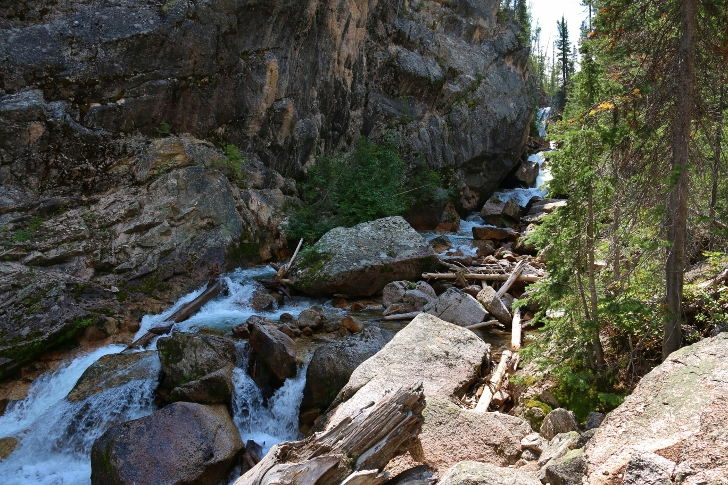
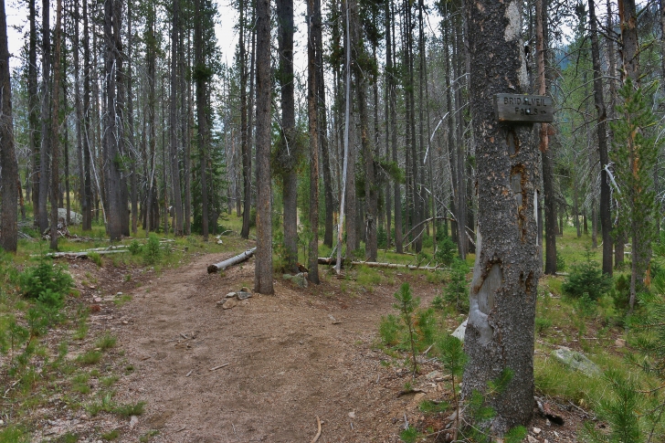
As you get closer to Lady Face Falls the valley narrows and the trail starts to climb.
As you cross the top of a hill in the trail watch to your left for this sign directing you to Lady Face Falls. This is about 2.4 miles from the trailhead.
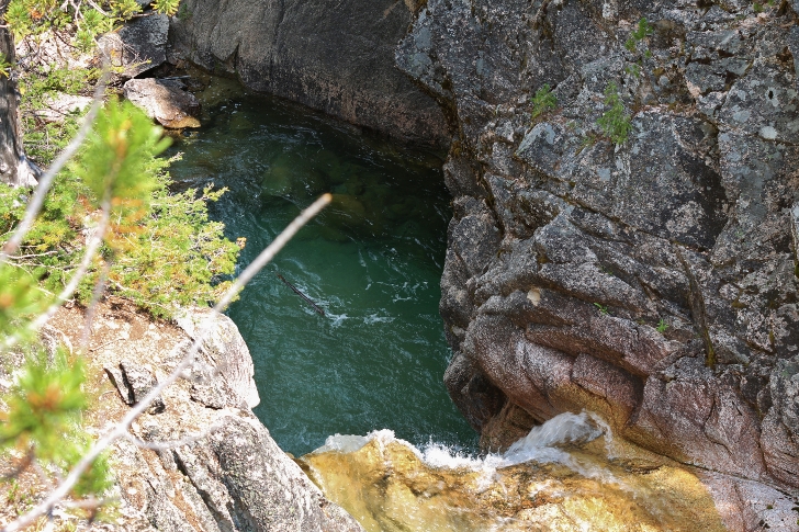
I climbed down into the canyon below the falls trying to get a good view. You can see the falls at the very top of the creek.
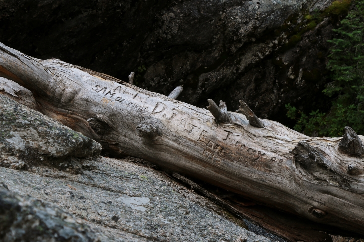
This log seems to be the place to leave your mark.
I could get no closer than this.
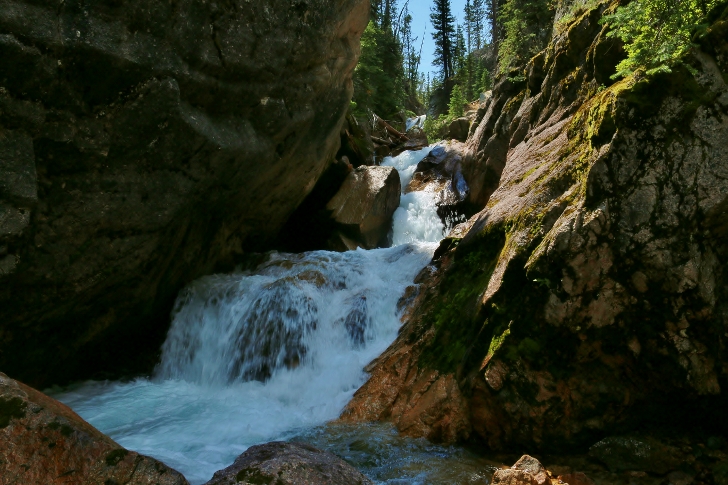
From the top of the falls I was able to get this picture
but the ground is sloped into the canyon and covered with loose sand and gravel, be careful.
N 44 13.840' by W 115 05.816'
Elevation here is 6750 feet
After crossing the creek .3 mile past the trail to Lady Face Falls the trail continues on toward my next stop, Bridal Veil Falls. This crossing here and at Bridal Veil Falls may not be possible early in the year as the creek may run to high and fast.
I believe this fork takes you to a path leading up the western side of the creek coming out of Hanson Lakes which is what makes Bridal Veil Falls.
From the trail it's not much of a view however if you are willing to work for it
Take this trail to wade the creek
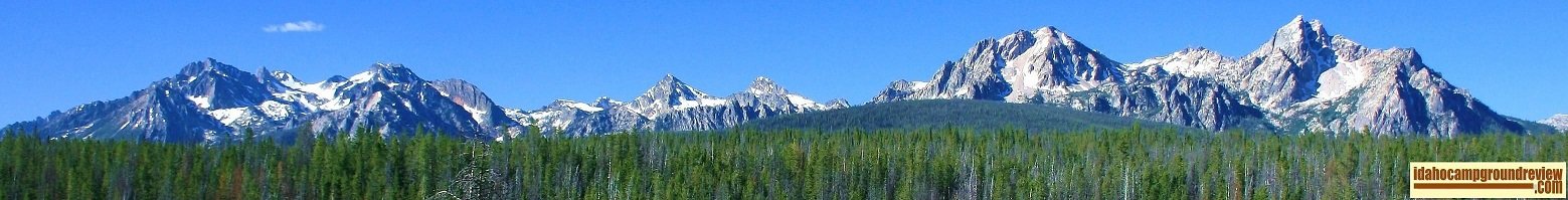
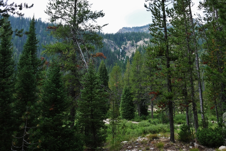
This is looking back the way I had just come. By the way, the mountains are so much bigger than they look here.
After a hard very steep climb with approximately 500 feet elevation gain I reached the foot of Bridal Veil Falls.
I have seen pictures taken from the west side of the creek and would like to try it someday.
Above the falls you will find Hanson Lakes, I hope to visit all 3 of them too.
N 44 12.694' by w 115 06.431'
Elevation is 7238 feet